Big Northwest floods a ‘dress rehearsal’ for a hotter climate
This week’s intense rainfall and flooding in northwestern Washington state and British Columbia offer a glimpse into the future, climate scientists say.
An atmospheric river – a massive conveyor belt of moisture from the subtropical Pacific Ocean – funneled a month’s worth of rain onto Whatcom County and southern British Columbia in a day or two.
Climate scientists say the Northwest should expect and prepare for more of the same, and worse, as heat-trapping pollution keeps sending the global climate into uncharted territory.
“We’re going to see events like this happen more frequently and we’re going to see events that are bigger than this one – a higher likelihood of bigger events,” University of Washington climate scientist Guillaume Mauger said.
“Record-breaking rain and flood events like this are exactly what we expect in a warmer Northwest,” University of Washington climate scientist Meade Krosby said in an email.
“The frequency, magnitude and duration of atmospheric rivers making landfall along the North American West Coast are projected to increase,” the latest report from the United Nations Intergovernmental Panel on Climate Change stated in August.
For every Celsius degree of warming, the scientific panel estimates, extreme storms over land are expected to dump 7% more precipitation.
Sponsored
Put simply: warmer air can hold more water and unleash more water.
Bellingham just had its rainiest two days on record, with 4.7 inches of rain, and its rainiest three-day period, with 5.6 inches, according to the National Weather Service. Over the past 30 years, the city has averaged 5.7 inches for all of November, its rainiest month of the year.
Rain across the region
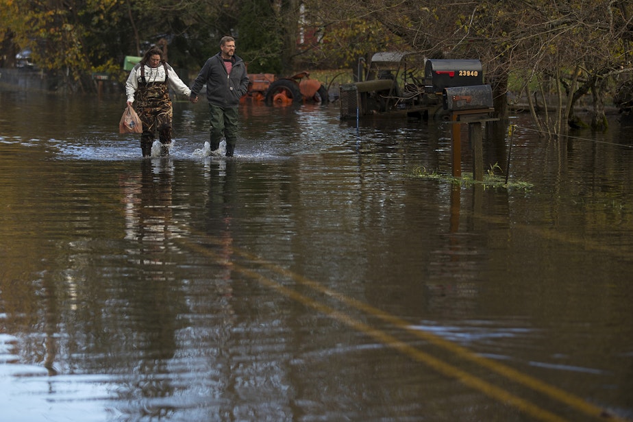
The powerful storm caused widespread flooding and landslides that shut down I-5 and cut off all roads to the Lummi Reservation outside of Bellingham.
“This rain came so fast and rained so hard that the river rose up to the levee quickly, so we didn't have time to prepare,” Lummi tribal chair William Jones Jr. said. “Nobody was prepared for the amount of rain that came down.”
Sponsored
To keep the Lummi tribal health clinic operating on Wednesday, Lummi Nation police boats ferried doctors, nurses, dentists, and a pharmacist to their jobs there, a 25-minute voyage across Bellingham Bay. To keep the reservation’s store stocked with food, the tribe had a dump truck plow through the floodwaters.
According to preliminary data from the U.S. Geological Survey, the Nooksack River, which stranded the Lummi Reservation and overtook the partially evacuated town of Ferndale, had its highest flow on record.
Nearby rivers including the Skagit and Samish didn’t break records but flooded to an extent expected once every 10 to 25 years, according to USGS’ preliminary data.
On the Olympic Peninsula, the Calawah River near Forks experienced an estimated 25-to-50-year flood, while the Elwha had a 5-to-10-year flood.
Quillayute Airport near Forks got 8 inches of rain on Nov. 14-15, its second-rainiest two-day period on record.
Sponsored
While this storm was intense, National Weather Service meteorologists say Washington has seen worse.
“We've had some awfully heavy rain events where, you know, 20 inches of rain fell over southwest Washington,” National Weather Service meteorologist Mike McFarland said.
The wettest areas in the North Cascades and Olympics got 15-20 inches of rain in a week, according to McFarland.
This storm hit hardest just north of the border.
Flooding and landslides severed road and rail access to the greater Vancouver, British Columbia, area, including Canada’s largest port. The Canadian Press reports 20 precipitation records being broken across the province. At least 18,000 were forced from their homes, and B.C. Premier John Horgan called it a once-in-500-year event.
Sponsored
"Backdrop of a warmer world"
Atmospheric rivers are nothing new: They are a major source of moisture up and down the West Coast every winter.
Climate scientists say atmospheric rivers might have already become more intense in the Northwest as the climate has warmed, but the trend is unclear.
“Teasing out a real and reliable trend in this kind of data is difficult because of the large variability [from year to year],” Washington state climatologist Nick Bond said in an email. “The data is noisy.”
Sponsored
Pinpointing the role of climate change in the latest atmospheric would require detailed analysis, which has not been done yet.
Scientists did such an “attribution analysis” of the Northwest’s record-shattering early-summer heat wave. They concluded the lethal heat wave would have been “virtually impossible” had humans not altered the climate by adding heat-trapping gases to the global atmosphere.
Four months later, much of a region that suffered through prolonged, extreme heat endured prolonged, extreme rain.
“We’re at a point where all weather events are happening on the backdrop of a warmer world,” Krosby said.
“The issue is no longer if climate change played a role in a particular extreme weather event,” Krosby said, but “to what degree warming made a particular event worse (e.g., more probable, larger, more intense).”
Climate scientists at the University of Washington and elsewhere have long urged the region to design and site buildings, roads, and other infrastructure to better withstand flooding from extreme storms and rising sea levels.
Mauger says this week’s destructive floods do have an upside: They can help inform preparations for stormier decades to come.
"I like to see these events as kind of a dress rehearsal for the future," Mauger said. “All those things are really valuable to be able to see firsthand.”
While the greater Seattle area experienced heavy rain, it was much less intense than farther north.
The past week saw 2.6 inches of rain fall on Seattle, according to Washington State University weather data, while the small settlement of Van Zandt on the South Fork Nooksack River got 8 inches, or three times as much.
On British Columbia’s Fraser River, the town of Hope, just upriver from a tiny town named Floods, recorded 9.9 inches of rain in three days.
-
John Ryan

Environment Reporter
John Ryan joined KUOW as its first full-time investigative reporter in 2009 and became its environment reporter in 2018. He focuses on climate change, energy, and the ecosystems of the Puget Sound region.
More stories from John Ryan »


