Washington is drawing new congressional maps. It’s getting heated
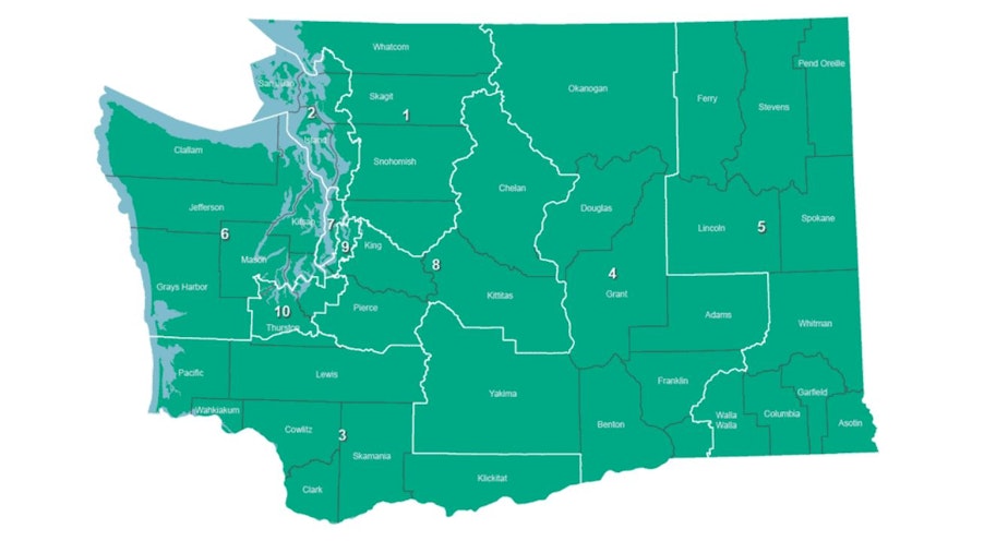
New proposed maps for Washington state's congressional districts are out today, but a partisan divide in the bipartisan commission has prompted different interpretations of how the maps should be drawn up.
One of the two Democratic appointees, former state lawmaker Brady Walkinshaw, said his top priority “is about is about keeping communities of interest together, whether those are tribal nations or cities and counties.”
Walkinshaw said he honored all requests he received from tribal nations.
On the other side, Republicans in the group said their goal is to ensure there are more competitive congressional seats.
“It’s not only important for democracy, it’s a legal requirement for the commission,” said former Republican state lawmaker Joe Fain (whose appointment to the group was controversial, after an earlier accusation of rape).
The bipartisan commission is formed every 10 years, after the census, to redraw Washington state's congressional and legislative maps. Two Democrats and two Republicans are appointed.
Sponsored
All four appointees released their proposed congressional maps today after sharing legislative map drafts last week.
Walkinshaw said one of the challenges the group faces is making sure each congressional district is the same size. Last time, each district included around 710,000 people. This year, that jumped to include around 770,000 residents.
The two sides will need to reach a compromise that somehow brings the four different maps together before Nov. 15, when the final version is unveiled.
You can check out the proposed maps here.
-
David Hyde

Reporter
David’s people-focused politics coverage tracks local and national races. At KUOW, David has also reported for our Hearken Team answering listener questions,and covered a variety of other topics ranging from vaccine hesitancy to climate change.
More stories from David Hyde »


