Some freeways may be useable following 'the Big One' per new modeling by UW
New modeling by the University of Washington of the impacts of a major Cascadia earthquake offers a less dire picture of the aftermath of the so-called "Big One" — specifically when it comes to highway bridges.
Previous earthquake preparedness exercises have assumed that Interstate 5 and the highways to the Pacific Northwest coast would be largely impassible after a magnitude 9 offshore Cascadia megaquake. The new analysis produced by researchers in the UW Department of Civil & Environmental Engineering for the Washington State Department of Transportation reconfirmed the predicted damage along the outer coast and its post-quake isolation. But it concluded the great majority of bridges in the inland I-5 corridor should remain standing.
“Along the coast, we’re thinking a lot of bridges will have a lot of damage,” said Professor Marc Eberhard, the principal investigator. “They’re going to be shaken a lot because they’re very close to where the earthquake is being generated.”
But, Eberhard explained, as you move inland from the Pacific Coast, the seismic energy decreases with distance. Additionally, he said the softer sedimentary rocks that happen to underlie the region’s biggest cities could absorb the high intensity motions that are most damaging. The research team also determined that typical Northwest highway bridges were built much stronger than the minimum design standard.
“Most of the bridges along I-5, they’re fine,” Eberhard predicted. “My expectation is that the vast majority of bridges along these major corridors will still be usable after a magnitude 9 earthquake off the coast.”
Sponsored
Eberhard said the purpose of the report was to help WSDOT prioritize future earthquake retrofits and to refine earthquake planning scenarios to be more realistic. The high-level modeling is not detailed enough to look up your own commute though, as it does not list damage estimates for specific bridges by name.
The UW team based their analysis on ground motion simulations the university has been refining for years. The researchers subjected digital models of simple, common highway overpasses or creek crossings to simulated earthquake shocks. This project was a continuation of a 2019 study that investigated the effects of simulated M9 ground motions on high-rise buildings.
State bridge engineer Evan Grimm said WSDOT was in agreement with the findings of the new 182-page report the agency paid for.
“We do feel a sense of optimism that the lifeline routes and the seismic retrofits we’ve done will have a good effect,” Grimm said in an interview Friday.
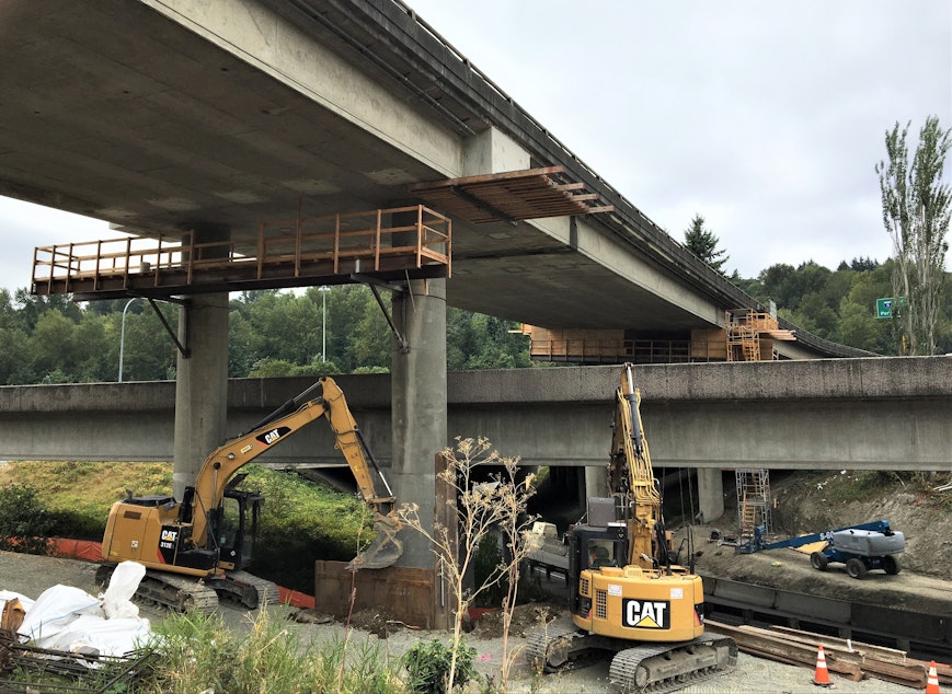
In the wake of the magnitude 6.8 Nisqually Earthquake in 2001, Grimm said WSDOT identified about 900 bridges requiring seismic retrofit, nearly all in Western Washington. Since then, the state has fully retrofitted 320 of those bridges and partially retrofitted an additional 115, he said. In some cases, old bridges are being replaced with bigger, stronger, all-new spans.
Sponsored
“We’re chipping away at it,” Grimm said. The same kinds of retrofits are happening in neighboring Oregon, too.
The reassuring earthquake engineering report comes with several important caveats. For one, landslides and retaining wall failures were outside the scope of this analysis, but those could block highways after a major earthquake even if the bridges are left standing. The modeling also did not factor in liquefaction, a phenomenon that can produce crazy tilts when soft soils or fill turns to a jelly-like consistency in an earthquake. The UW team hopes to incorporate liquefaction risk in a future analysis.
Eberhard said the revised, more optimistic Cascadia earthquake scenario doesn’t mean residents in the populous I-5 corridor can let down their guard. The seismic engineer remains concerned about the possible severe impact of other lesser known quake faults, such as the Seattle Fault and South Whidbey Fault. Those are just two among a spider web of crustal faults under the Pacific Northwest.
Individually, they spawn earthquakes less often than the offshore Cascadia subduction zone, cause less widespread damage and have a lower maximum magnitude of around 7.5. But collectively there are so many of these faults -- and they are closer to major cities -- to leave Eberhard feeling there is more work to do to understand the risks and reinforce critical infrastructure.
“For the whole region, the M9 is the one that is characterized as shutting down the west part of the state, but that’s not likely. I’m more worried about a Seattle Fault earthquake, but those only occur every 2,000 years, ” said Eberhard.
Sponsored
Earlier this year, the Washington Legislature specially directed WSDOT to assess the seismic risk to a 10-mile stretch of I-5 through the heart of Seattle and come back with recommendations and cost estimates for mitigation. The mostly elevated freeway section (from Boeing Field to Lake City Way) has so many vulnerabilities it is generally assumed to be non-functional when planning for earthquake relief and recovery. But WSDOT said in an interim report to the Legislature submitted on December 1 that it recognized “the critical role this segment plays in moving people and goods in the region.” The agency said it was working to figure out what would be needed for “quick recovery” of the I-5 mainline in Seattle after a strong earthquake.
Copyright 2022 Northwest News Network
-
Tom Banse

Regional Correspondent
Tom Banse covers national news, business, science, public policy, Olympic sports, and human interest stories across Washington state. Now semi-retired, Banse is an Olympia-based reporter with more than three decades of experience covering the Pacific Northwest. Most of his career was spent with public radio's Northwest News Network, but now in semi-retirement his work appears on multiple nonprofit news outlets including KUOW. His recent areas of focus range from transportation, U.S.-Canada borderlands, the Northwest region's planned hydrogen hub, and emergency preparedness.
More stories from Tom Banse »