What have we learned in the decade since the deadliest landslide in U.S. history?
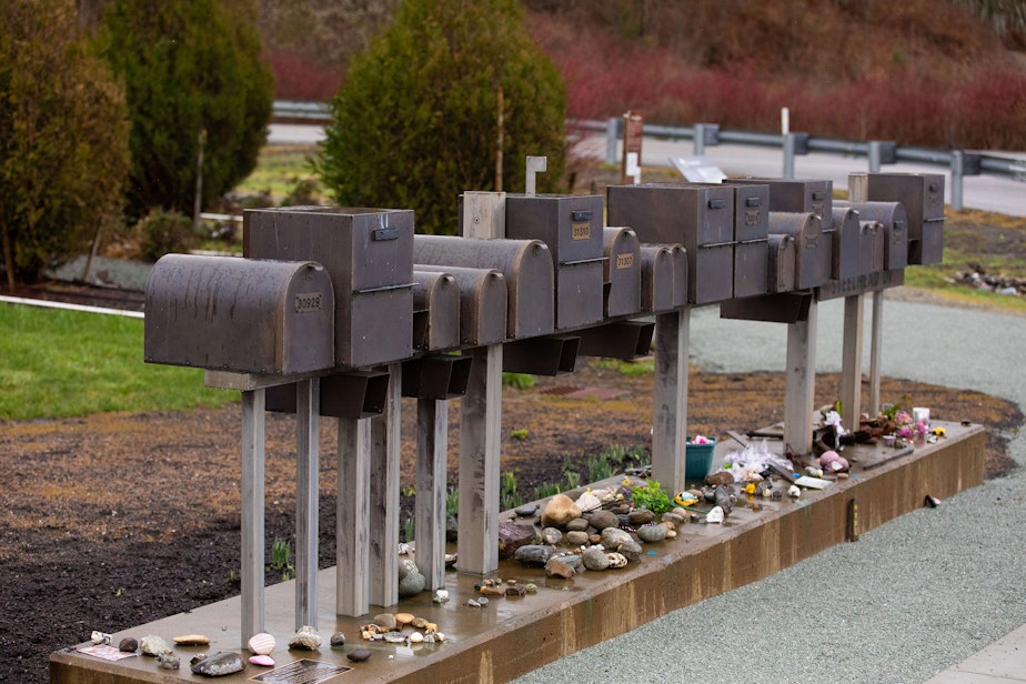
This week marks the tenth anniversary of the Oso landslide, a disaster that claims the lives of 43 people caught in its wake.
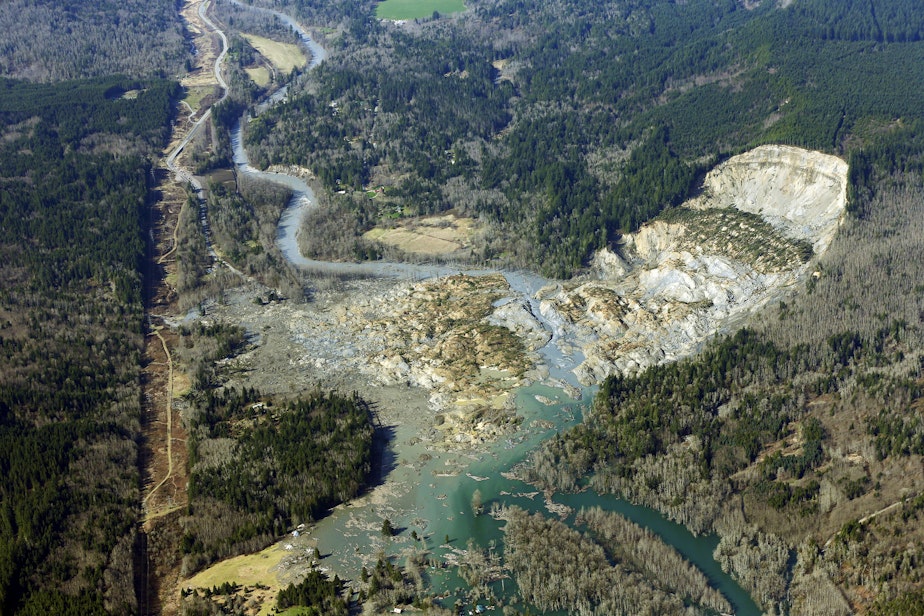
On March 22, 2014, a wall of mud and debris rushing 60 miles an hour hit the neighborhood of Steelhead Haven, near the North Fork of the Stillaguamish River along Highway 530.
It remains the deadliest landslide in US history. The fallout begs the question: Since the disaster, have local governments learned how to respond to the risk of landslides?
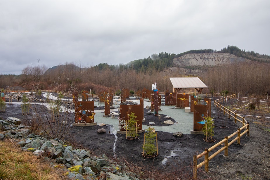
RELATED: 10 years after Oso landslide, a new memorial is a gathering place for remembrance
The slide was caused by "a lot of rain," said University of Washington geomorphologist David Montgomery. "The other potentially contributing factors — people have talked about forestry practices, the river cutting the toe of the slope out certainly didn't help over the long run. But the proximal cause was a whole mess of water."
Sponsored
Rain fuels landslides, which is why Washington and Oregon are some of the most landslide prone states in the country.
It's unclear whether climate change is currently affecting landslide risk.
KUOW environment reporter John Ryan said it's difficult for scientists to determine whether rain has intensified, yet.
"Climate scientists expect that, as there's more energy in the atmosphere, the hydrological cycle will speed up and we'll have more intense rainstorms," Ryan said.
Previous slides happened near Steelhead Haven in 1951, 1967, 1988, 1996, and 2006. Even after the 1967 slide, which destroyed structures in the area, more homes were built there in the 1970s.
Sponsored
Montgomery said that the landslide risk was not unknown. The state and federal government had mapped landslides in the area, but the homes were not built directly on previous landslides.
"A really critical component of translating landslide hazard into landslide risk is not just where the slides actually are, but where they're going to end up," Montgomery said.
Since the Oso slide in 2014, some counties have increased scrutiny of homes built near slide areas.
Under the state's Growth Management Act, cities or counties decide what places should be considered a landslide hazard.
Sponsored
Before 2014, Snohomish County, where the Oso slide occurred, restricted building in landslide zones and in the area around those zones, where mud or rocks might pour into. Snohomish County increased the size of those buffer zones about a year after the Oso slide.
RELATED: Oso Community: In Their Own Words
The new buffer zone "still wouldn't have protected the homes in Oso that were destroyed," Ryan said. "It was such an extreme landslide that it crossed the river and ran for nearly a mile."
Pierce County has one of the biggest buffer zones, at around 300 feet from a slide area. King County has a significantly smaller buffer zones, in some cases just 50 feet around a slide area.
At the federal level, Sen. Maria Cantwell (D-WA) and Sen. Lisa Murkowski (R-AK) introduced a bill in February that would reauthorize the National Landslide Preparedness Act.
Sponsored
Cantwell and Murkowski's bill would also continue funding for mapping landslide zones, making $40 million per year available through 2034 for the task. Mapping landslide zones helps builders and homeowners better understand slide risks.
RELATED: After Oso, Reborn From Water And Mud
The Washington Department of Natural Resources has mapped about a half dozen counties in the state, which means there are more than 30 counties left to map.
Beyond that, the federal government's role is small. The big decisions happen at the local level.
Sponsored
Ryan said that landslide preparedness raises the same question as other natural disasters: how much risk to let builders and homeowners take on, and how much to restrict building in known hazard areas.
"It's basically the same tension or policy question for landslides, for wildfires, floods," he said, "all of these disruptive natural processes that we expect will get more intense as our climate keeps heating up."
-
Libby Denkmann

Host, Soundside
Libby Denkmann joined KUOW in December 2021 as the host of the midday show Soundside. She’s a native Pacific Northwesterner who grew up in Redmond, graduated from the University of Washington, and covered local news as a producer and reporter with KIRO Radio.
More stories from Libby Denkmann » -
Sarah Leibovitz

Supervising Producer, Soundside
Sarah joined KUOW in 2019 as senior producer on The Record. She is now Supervising KUOW’s new noon time show, Soundside. Prior to working at KUOW, Sarah was lead producer at the Seattle podcast production company Larj Media, and a teaching artist with Path with Art.
More stories from Sarah Leibovitz » -
John Ryan

Environment Reporter
John Ryan joined KUOW as its first full-time investigative reporter in 2009 and became its environment reporter in 2018. He focuses on climate change, energy, and the ecosystems of the Puget Sound region.
More stories from John Ryan »


